Walking itinerary: Chalets de Pertuis from Les Ogays

  • Sport
  • Pedestrian sports
  • Hiking itinerary
Elevation : 1783m
Chez Les Ogays, Richebourg, 74360 Abondance

Description

Hiking in the "Mont de Grange" hunting reserve, which has more than 500 chamois deer and mouflon sheep. Pertuis is also an area where marmottes have been reintroduced. Enjoy your walk.
A medium difficulty hike in the Mont de Grange hunting reserve, the highest mountain in the valley at 2432m. It is a Natura 2000 reserve where chamois, mouflons and marmots live together. The departure is located at Chez les Ogays at the start of Richebourg in Abondance. You will take the direction of the Chalets de la Plagne and discover its mountain pastures. You will join the discovery trail "in the footsteps of the Chamois" passing by the Chon and the Chable de la Plagne to reach Pertuis. At the chalets of Pertuis, you will discover an ancient glacial valley with a small lake carved by the glacier, which dries up at the end of the summer, and its large lateral moraine. To go back down, you will continue on the Bel Air ridge (1783 m) with a magnificent view of Abondance and the surrounding mountains. You will then reach the chalets of Leschaux and Plaine Joux. You will then head towards the Chosalets to reach the start of the hike. Marking details : Departmental markings called P.D.I.P.R. on beige metal panels with green lettering. Map references : - Map guide to 65 walks and hikes in the Evian region and Abondance valley - Map of walking routes in the Portes du Soleil area in France and Switzerland - IGN TOP 25 No. 3528 ET Morzine Chablais Massif Portes du Soleil Whatever your hike, remember to take cereal bars, sufficient water, sunglasses, sun cream, a small first aid kit, as well as clothes adapted to your outing according to the season and the weather forecast.
  • Sustainable tourism
    To respect farming practices, natural areas and wildlife, please keep your dogs on a lead and pick up after them. Keep and sort your rubbish, stay on the paths and close the fences.
  • Guidebook with maps/step-by-step
    0/ Chez Les Ogays à Richebourg in Abondance.
    1/ Cross the bridge over the Dranse then turn right. Follow the direction of "La Plagne", you will go along its chalets.
    2/ Take the direction of " Le Chon ".
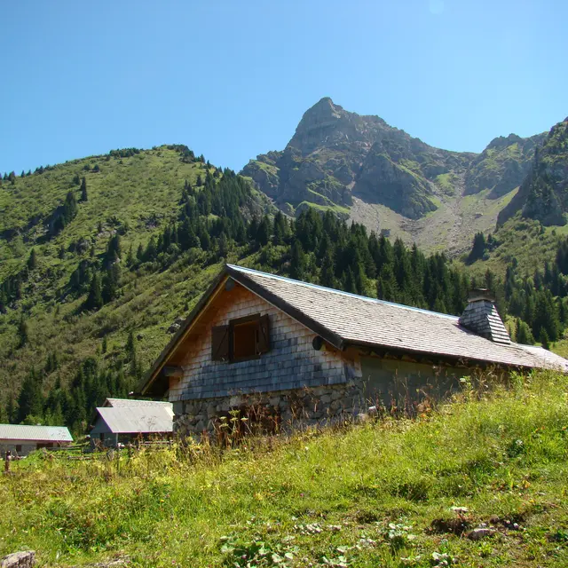
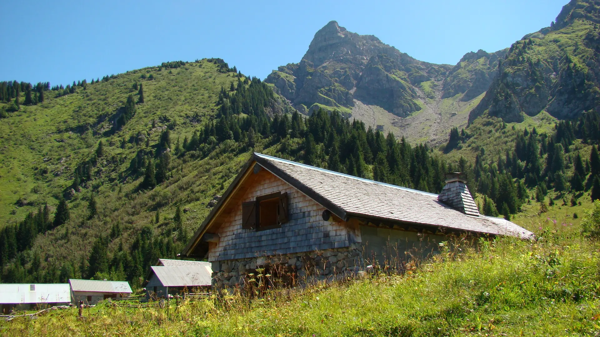
    3/ When you arrive at "Le Chon", take the trail that goes up on your left towards "Chalets de Pertuis".
    4/ At the crossroads of " Chable de la Plagne ", follow the direction of " Pertuis " on your left. After 5 min, the trail to Pertuis starts on the right towards the pasture. Continue to the chalets of Pertuis.
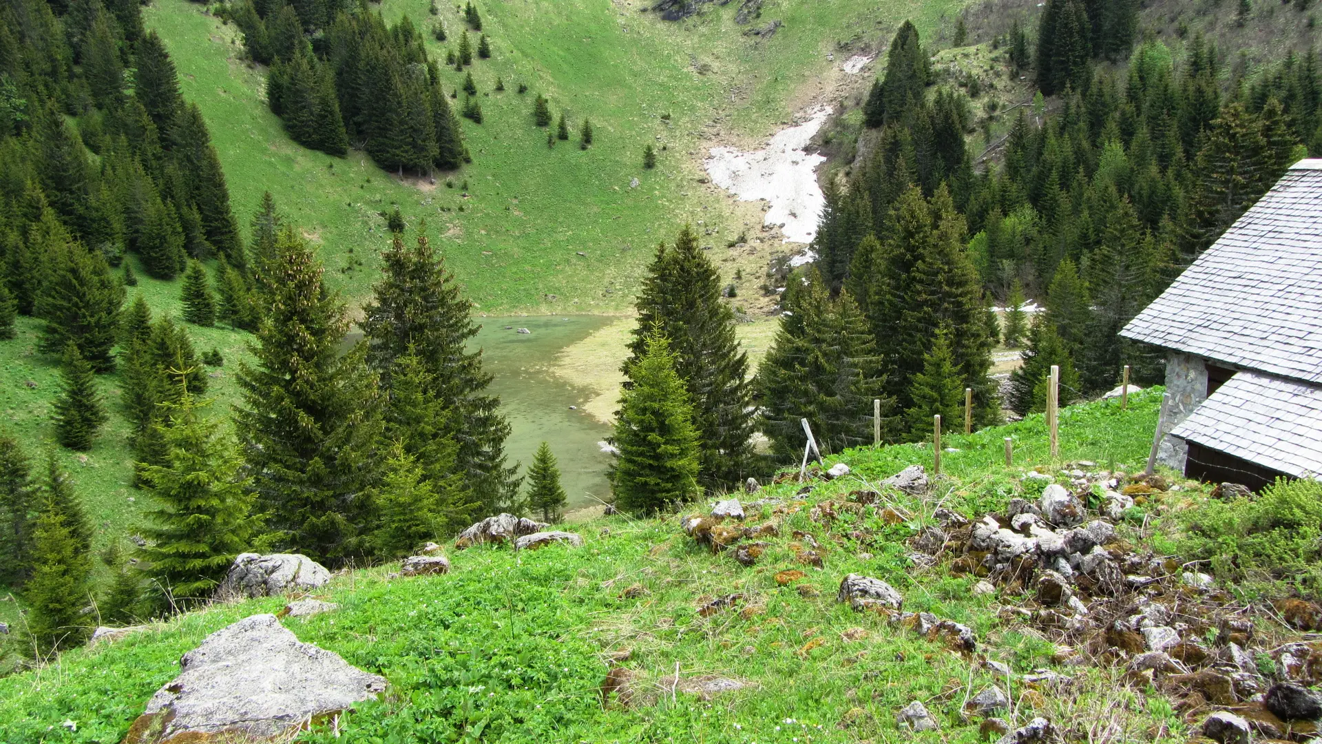
    5/ To go back down, you have the choice between the ascent route or to continue on the ridge of " Bel Air " (1783 m).
    6/ Go back down to the " Chalet de Leschaux " and continue towards the chalets of " Plaine Joux ".
    7/ From there, take the direction of " Chosalets ", then the direction of " Chez les Ogays ".
Plain text period
From 01/06 to 15/10 daily.
Check with tourist offices in advance to find out the current access conditions.

Subject to favorable snow and weather conditions.

Services

Car park
Animals accepted

Accessibility

Not accessible in a wheelchair

Environment

  • Forest location
  • Near shuttle stop
  • Close to a public transportation
  • Village 2 km away
  • Bus stop < 500 m
  • Sensitive Natural Area
Updated on 05 November 2025 at 10:41
by Office de Tourisme Leman Mountains Explore
(Offer identifier : 444606)
Report mistake
Filter search
Page types
  • All
  • Articles
  • Agenda
  • Lists